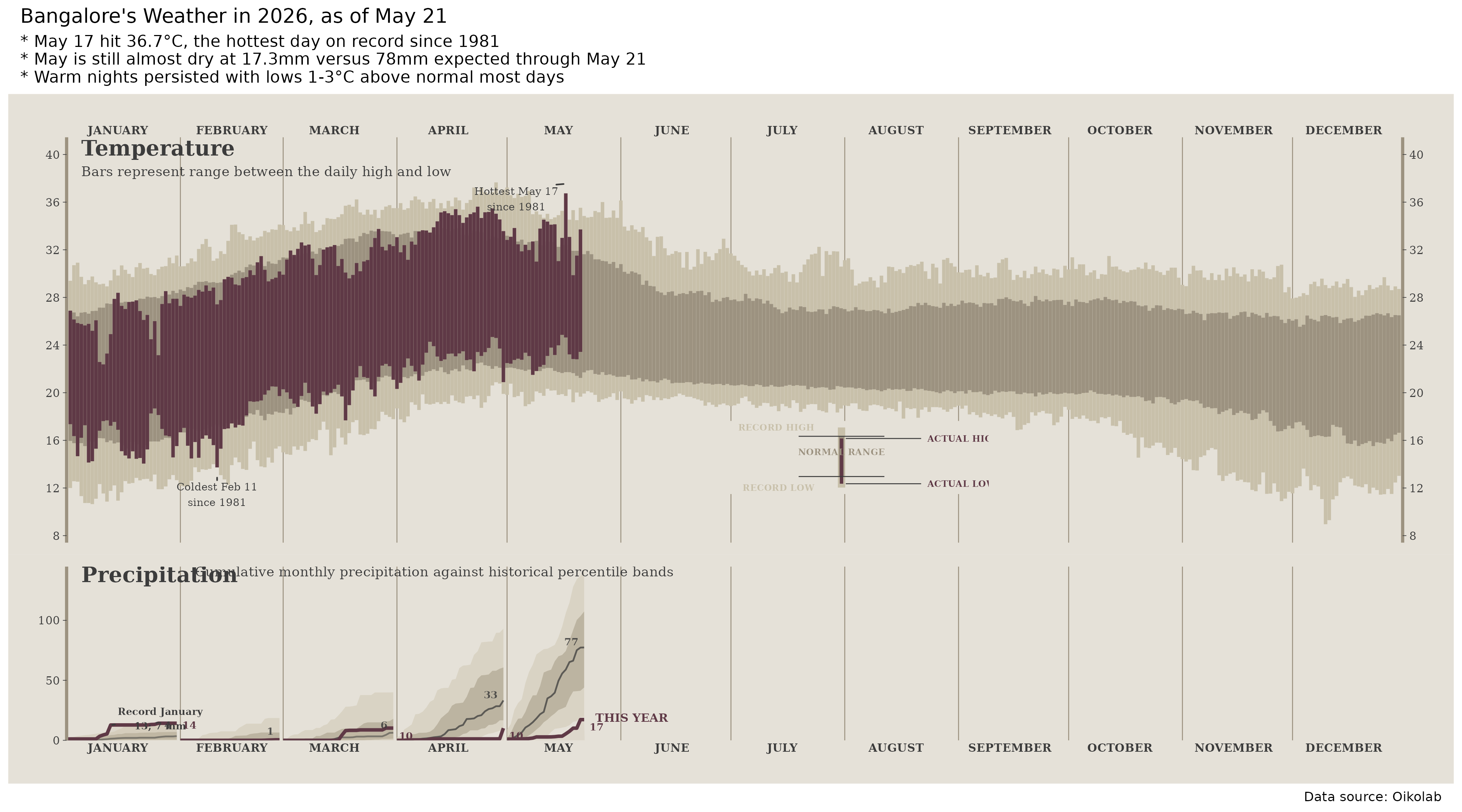
What this chart is doing
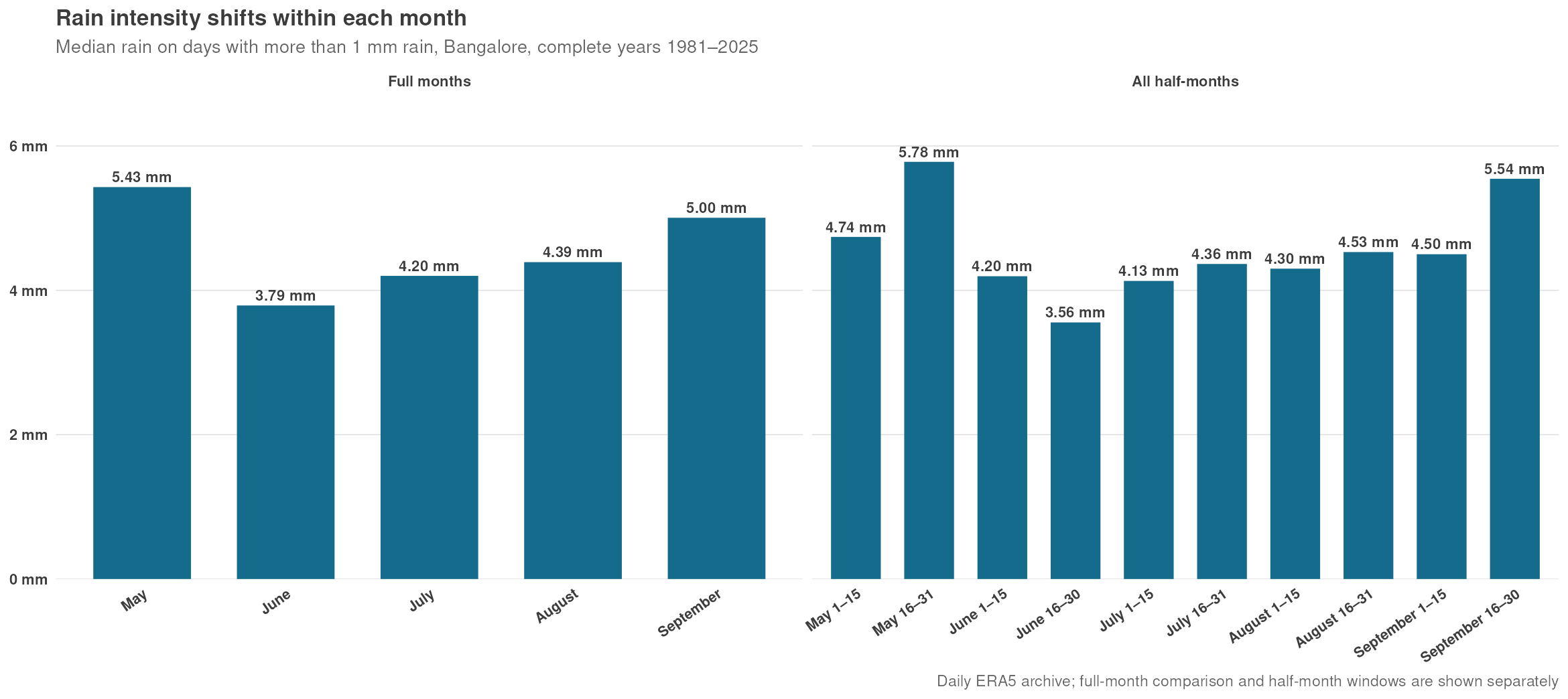
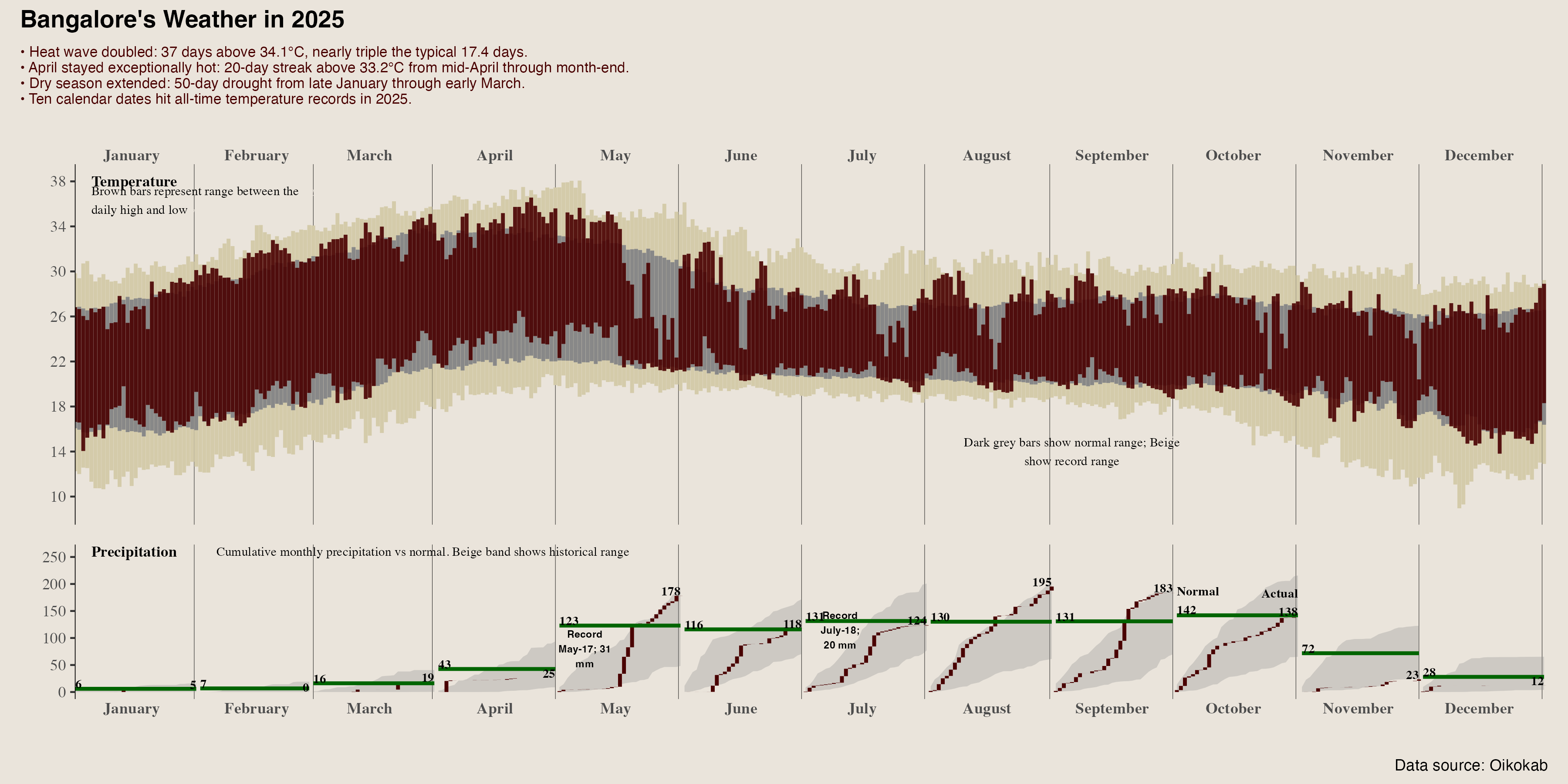
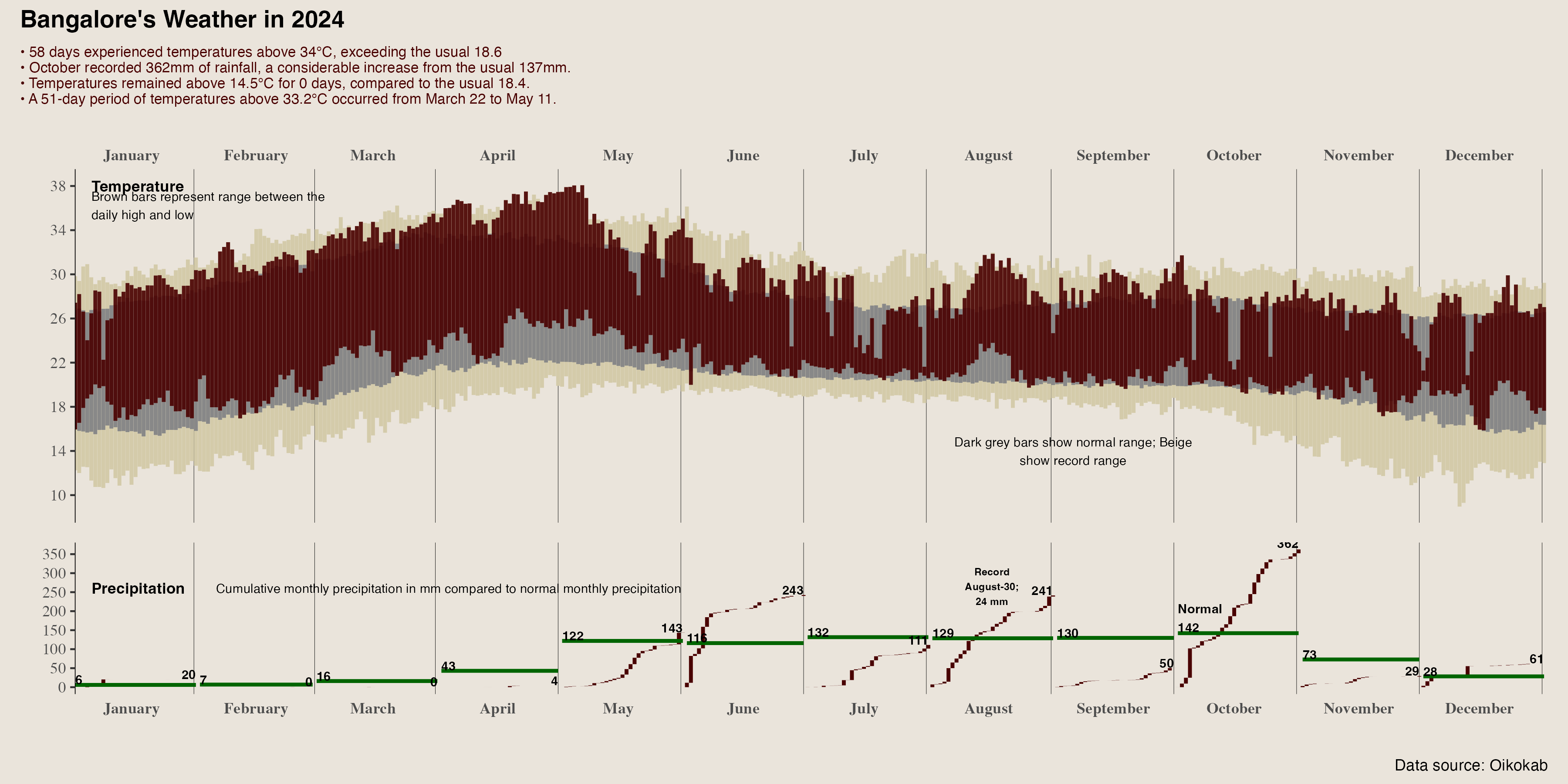
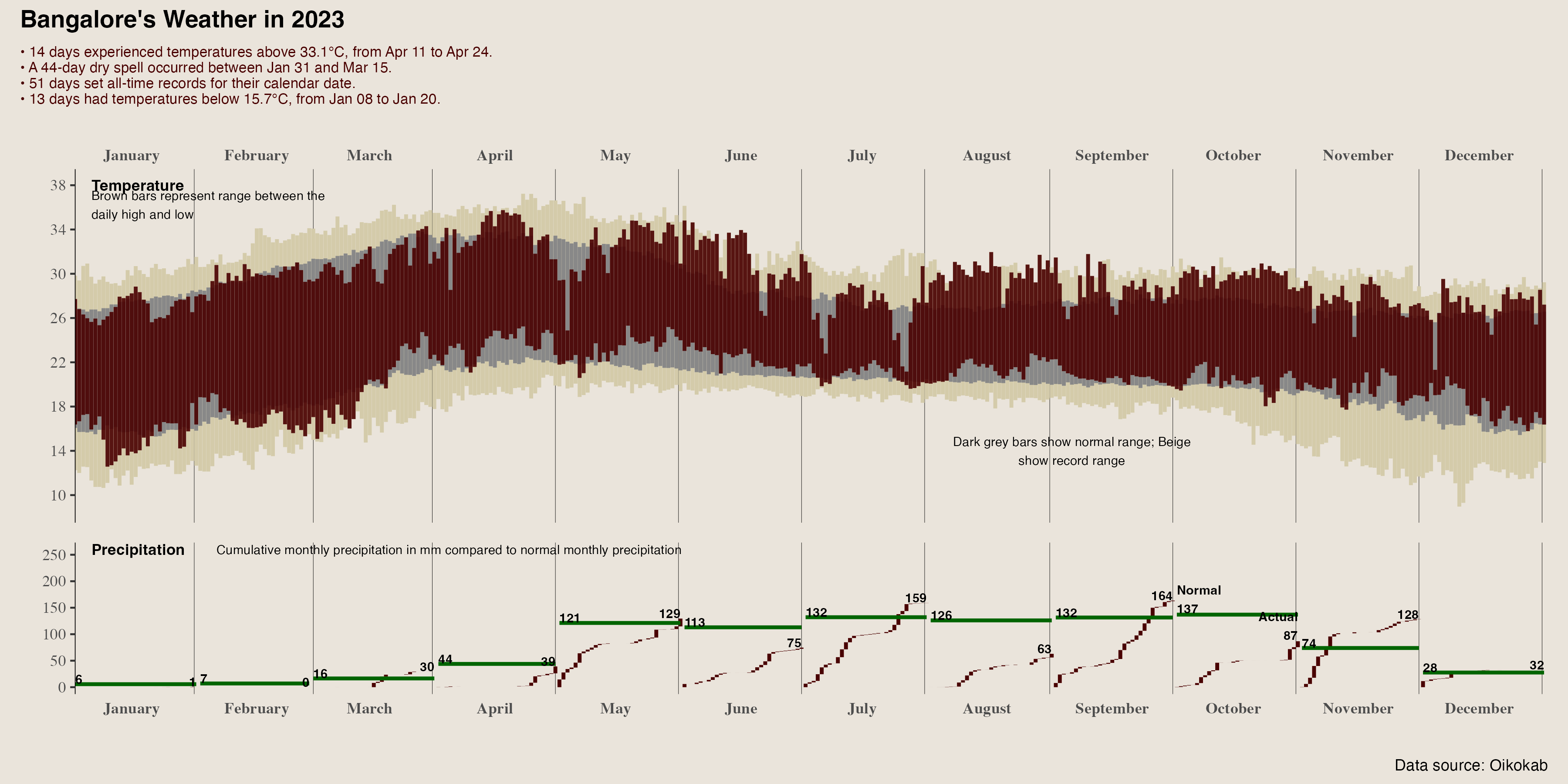
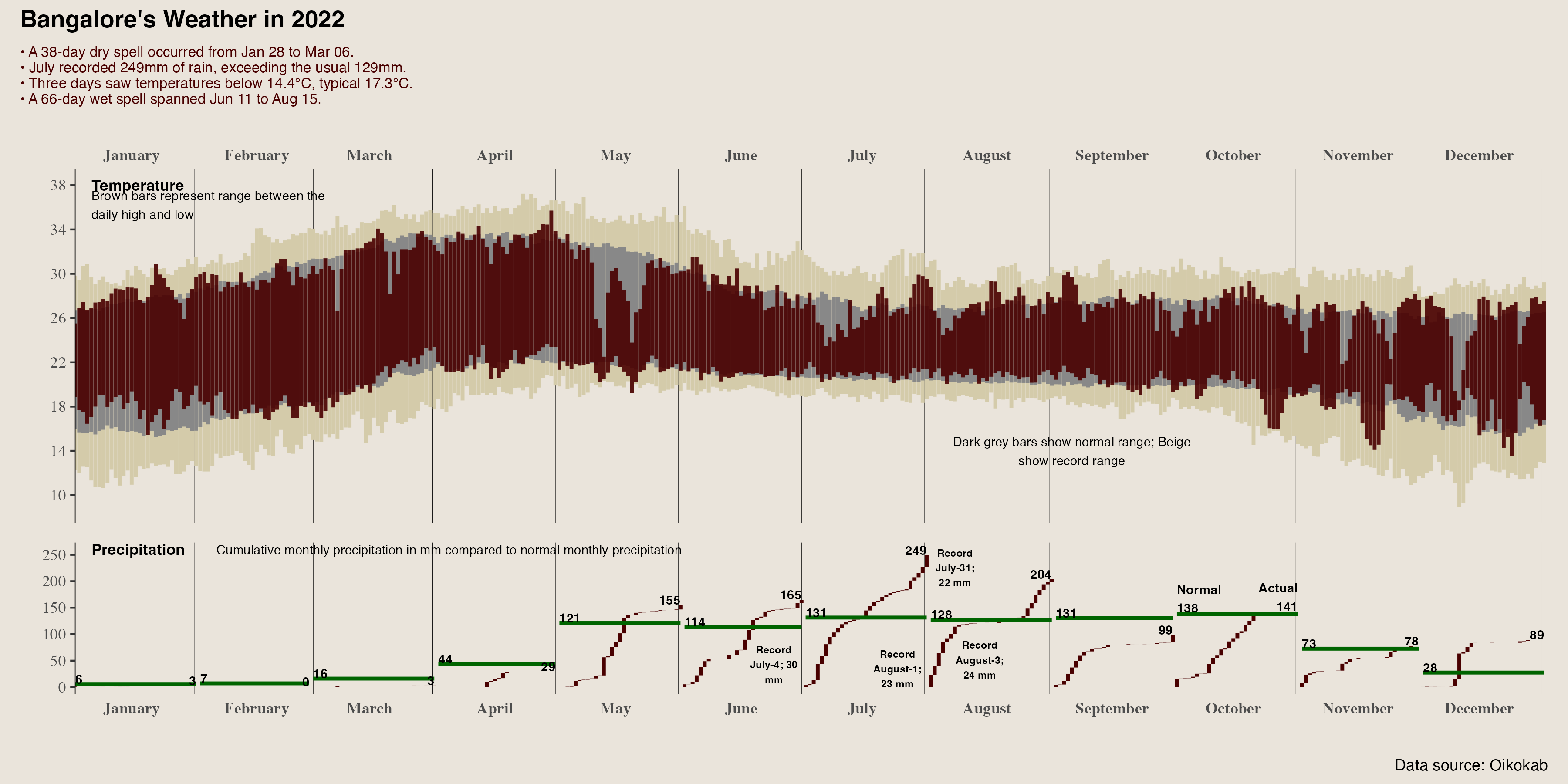
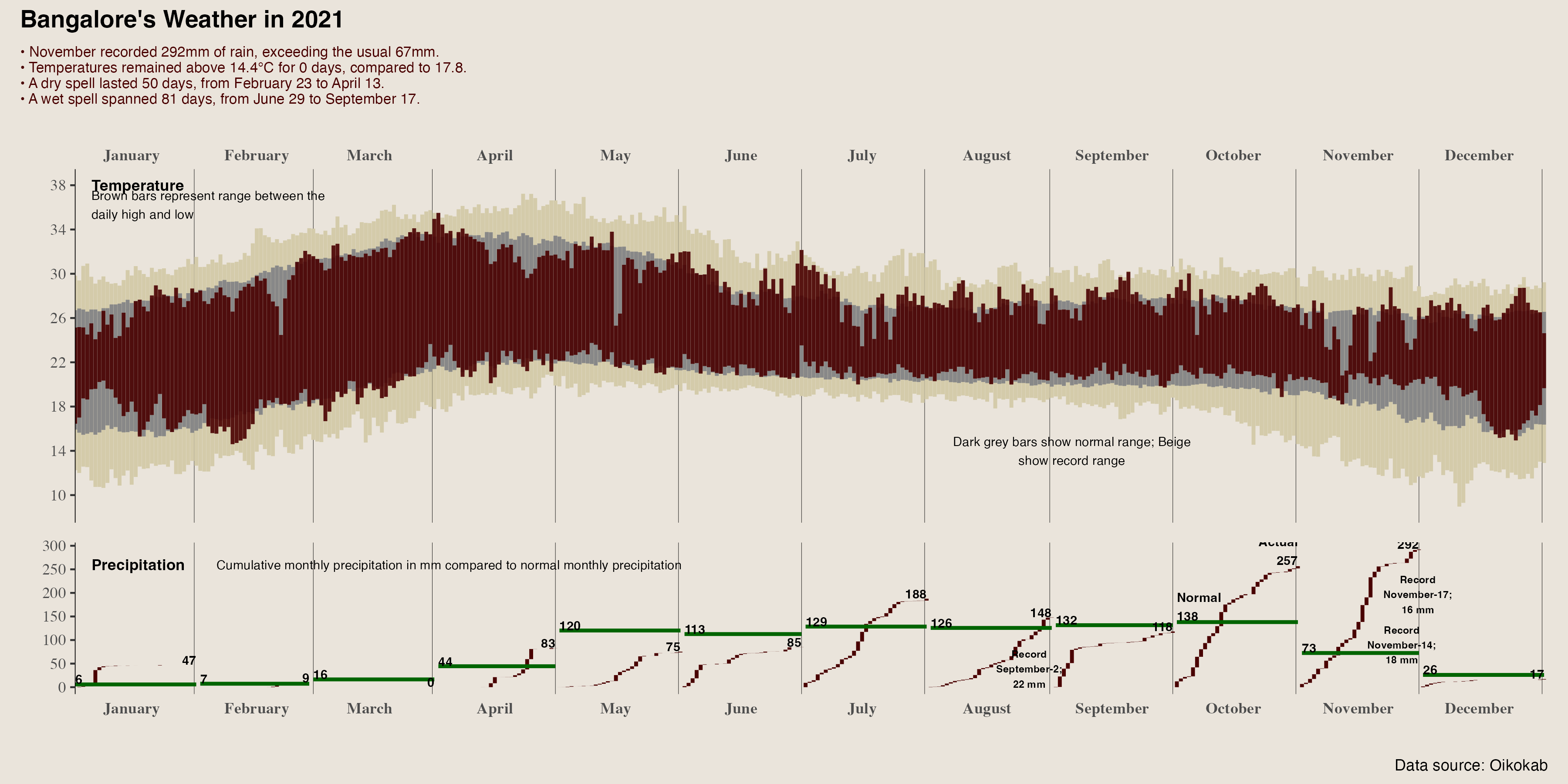
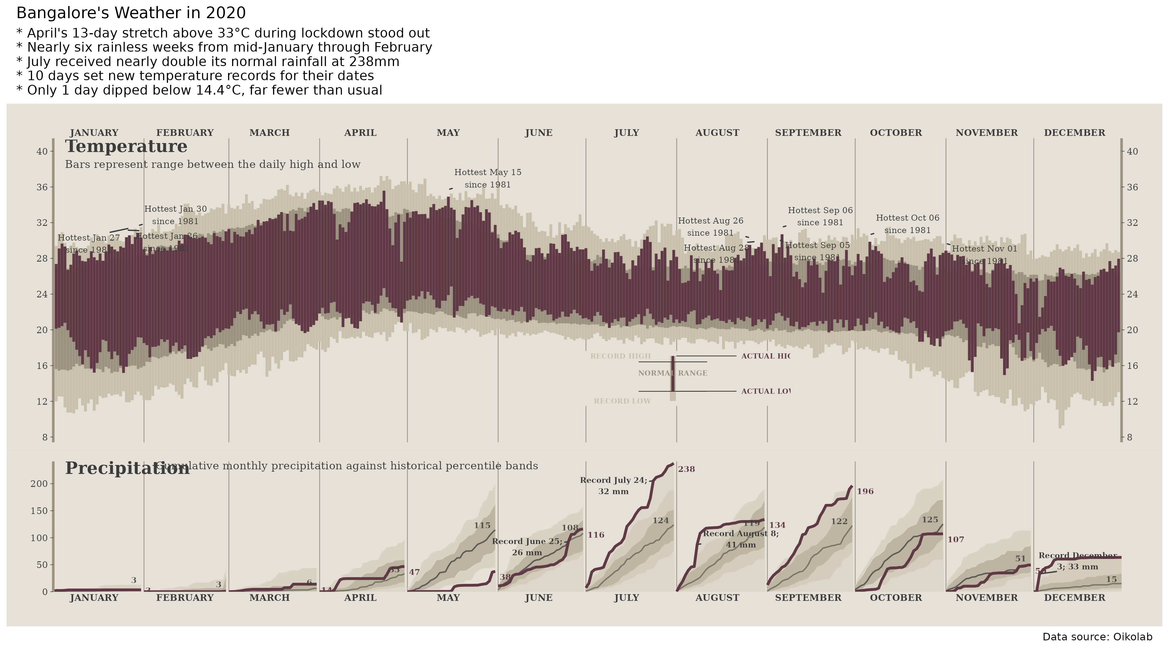
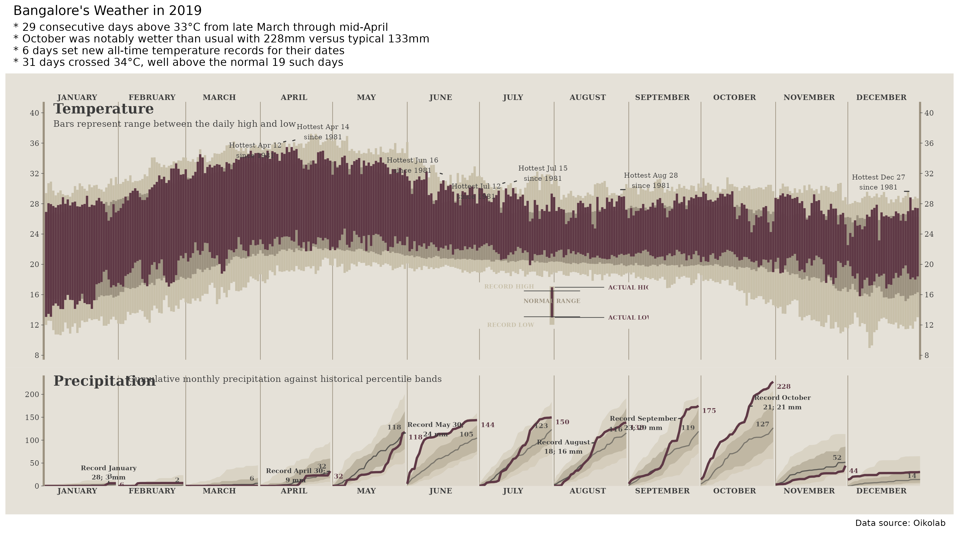
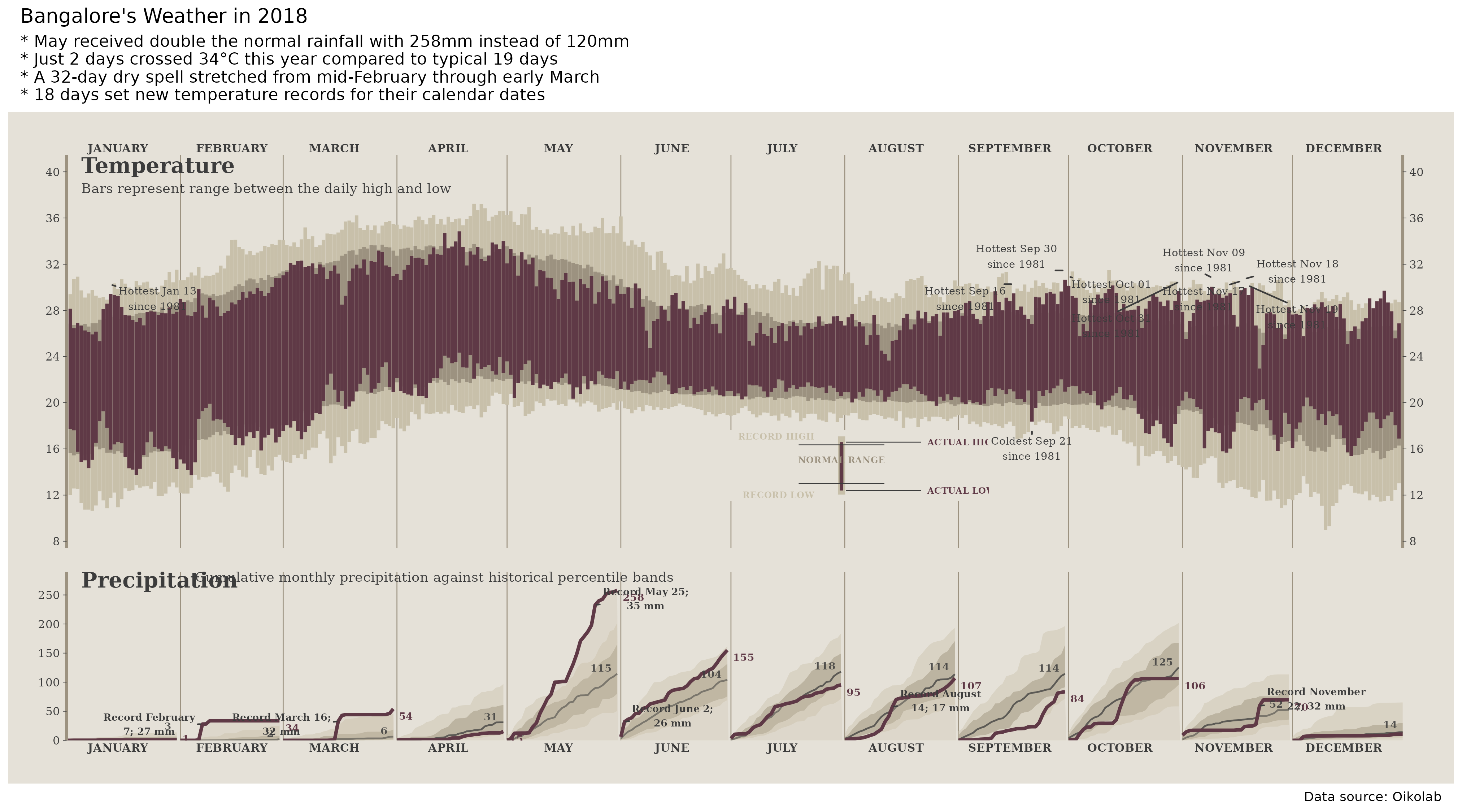
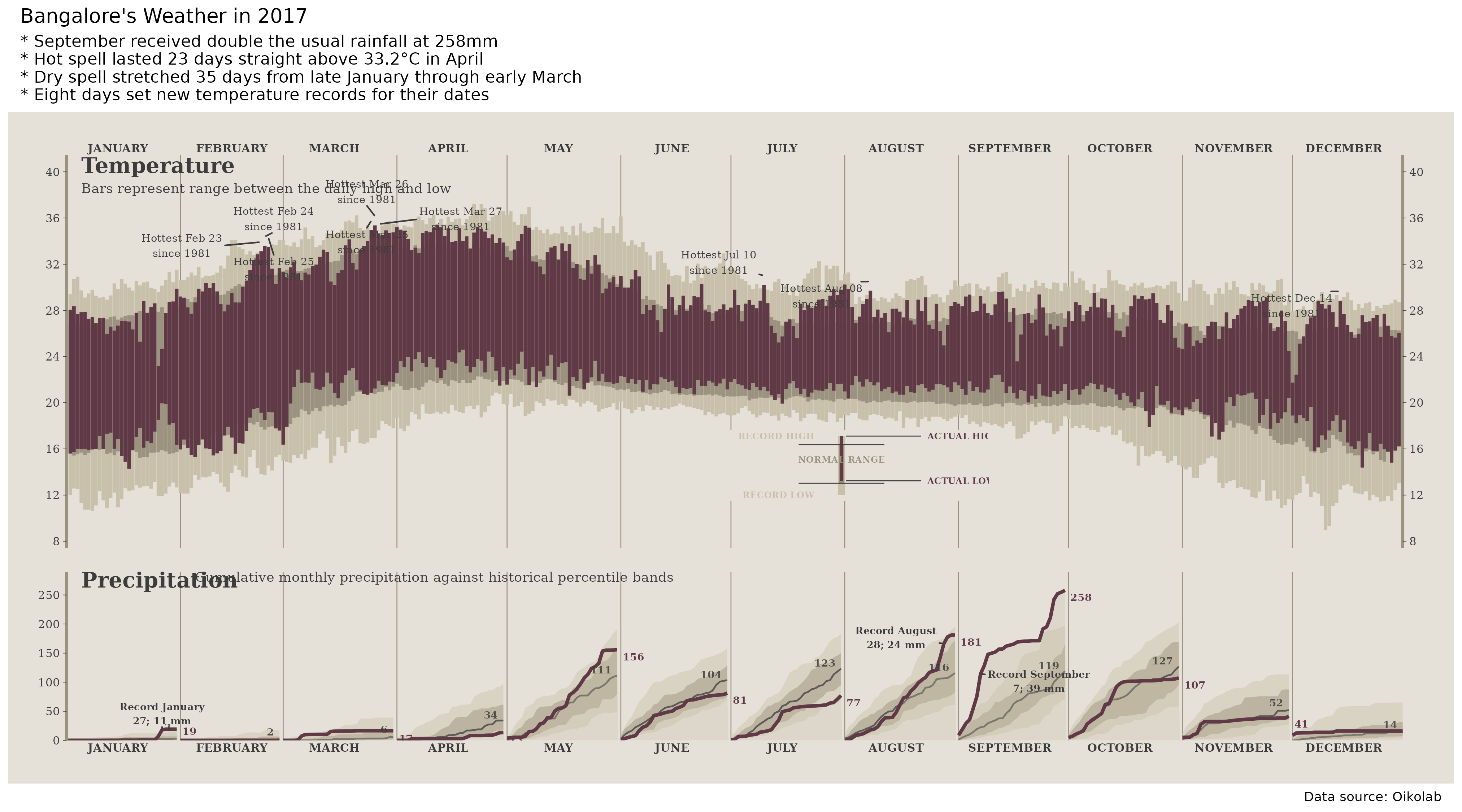
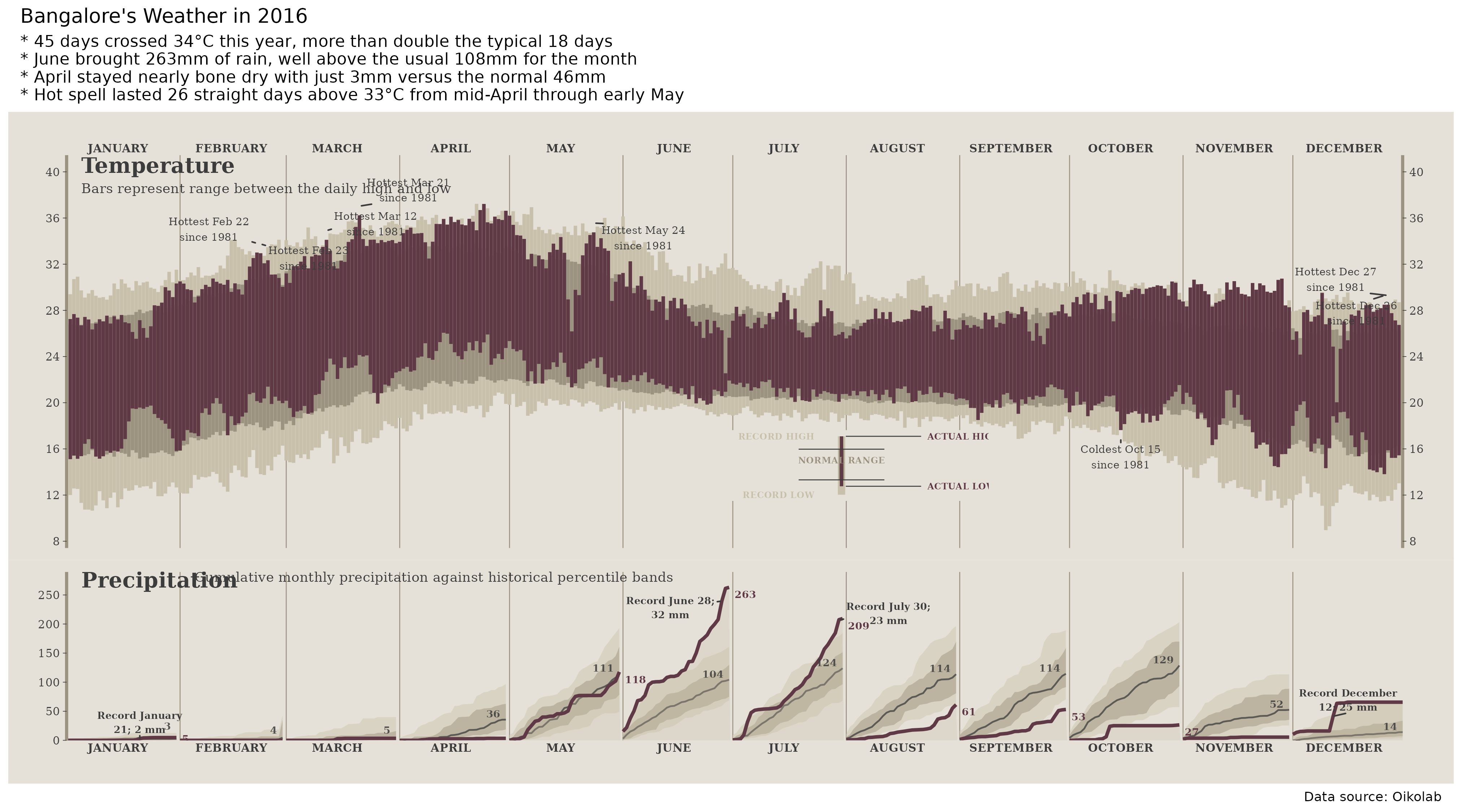
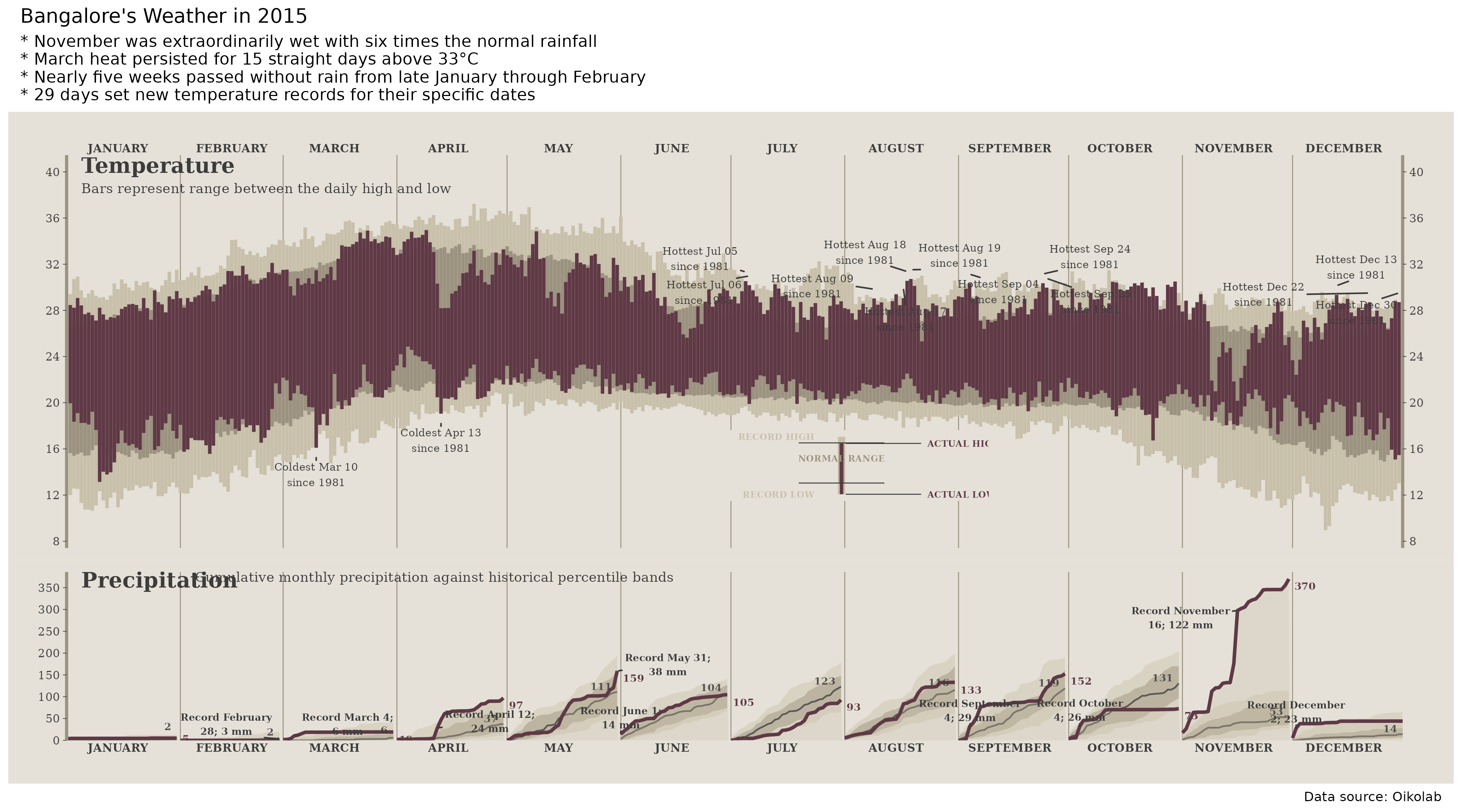
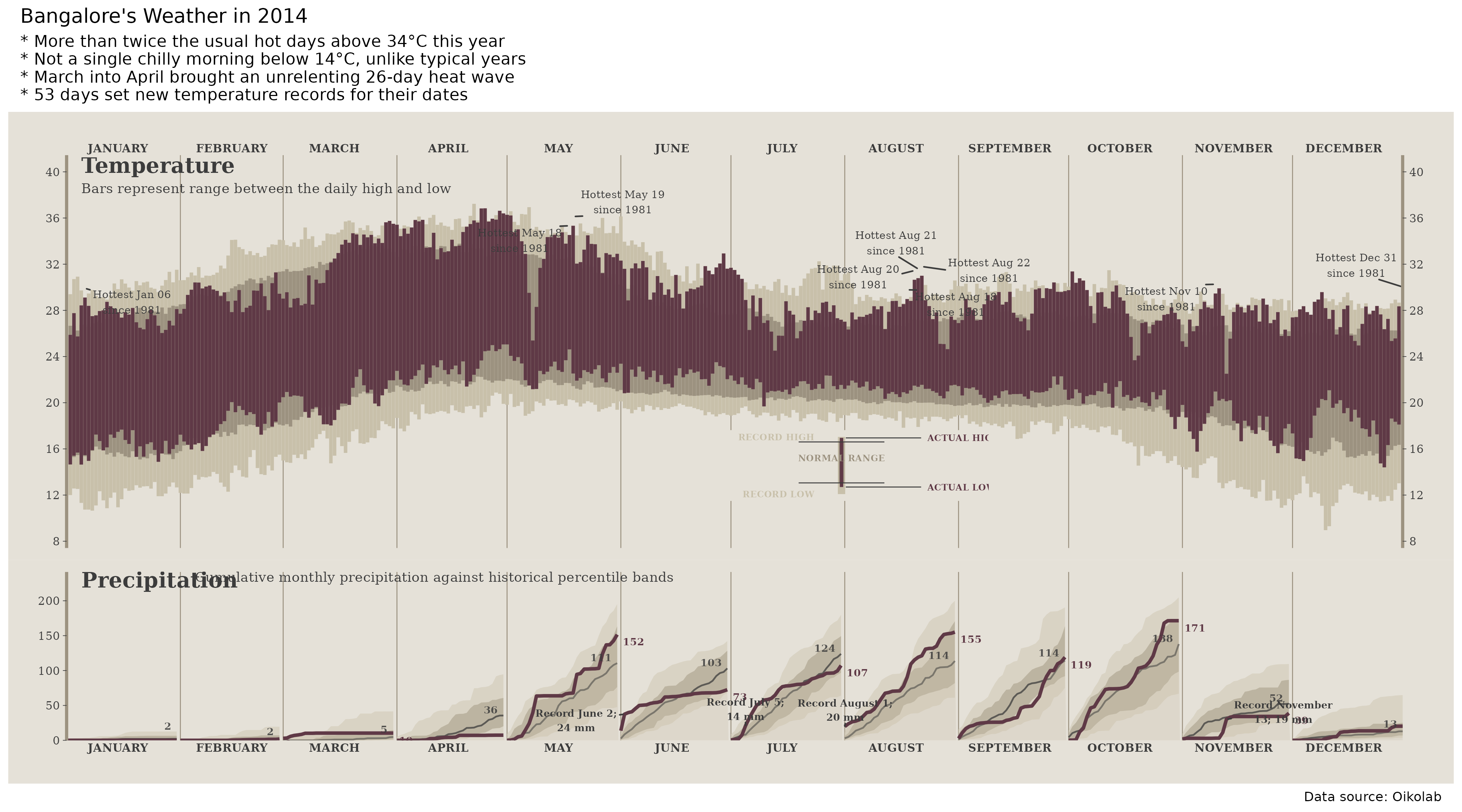
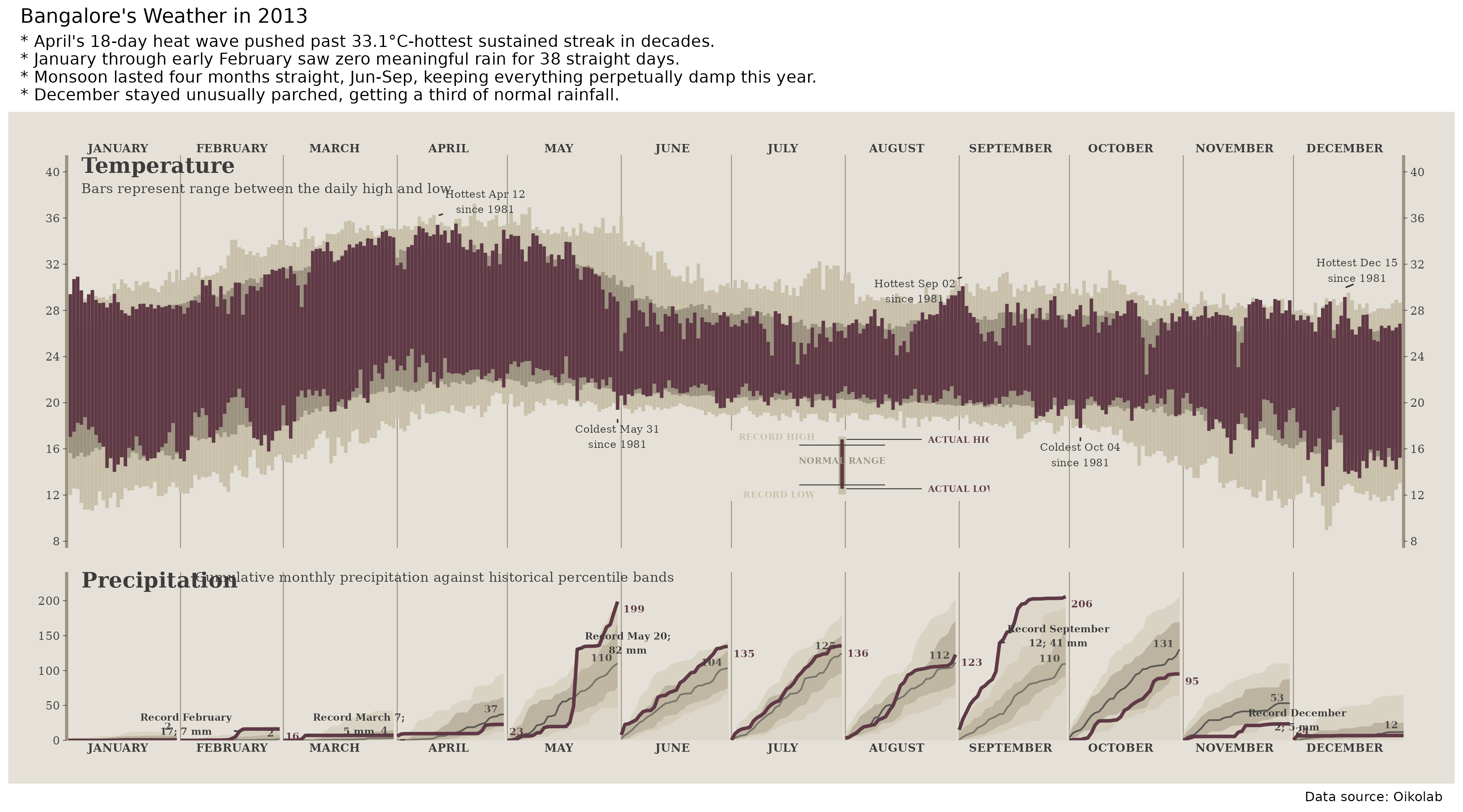
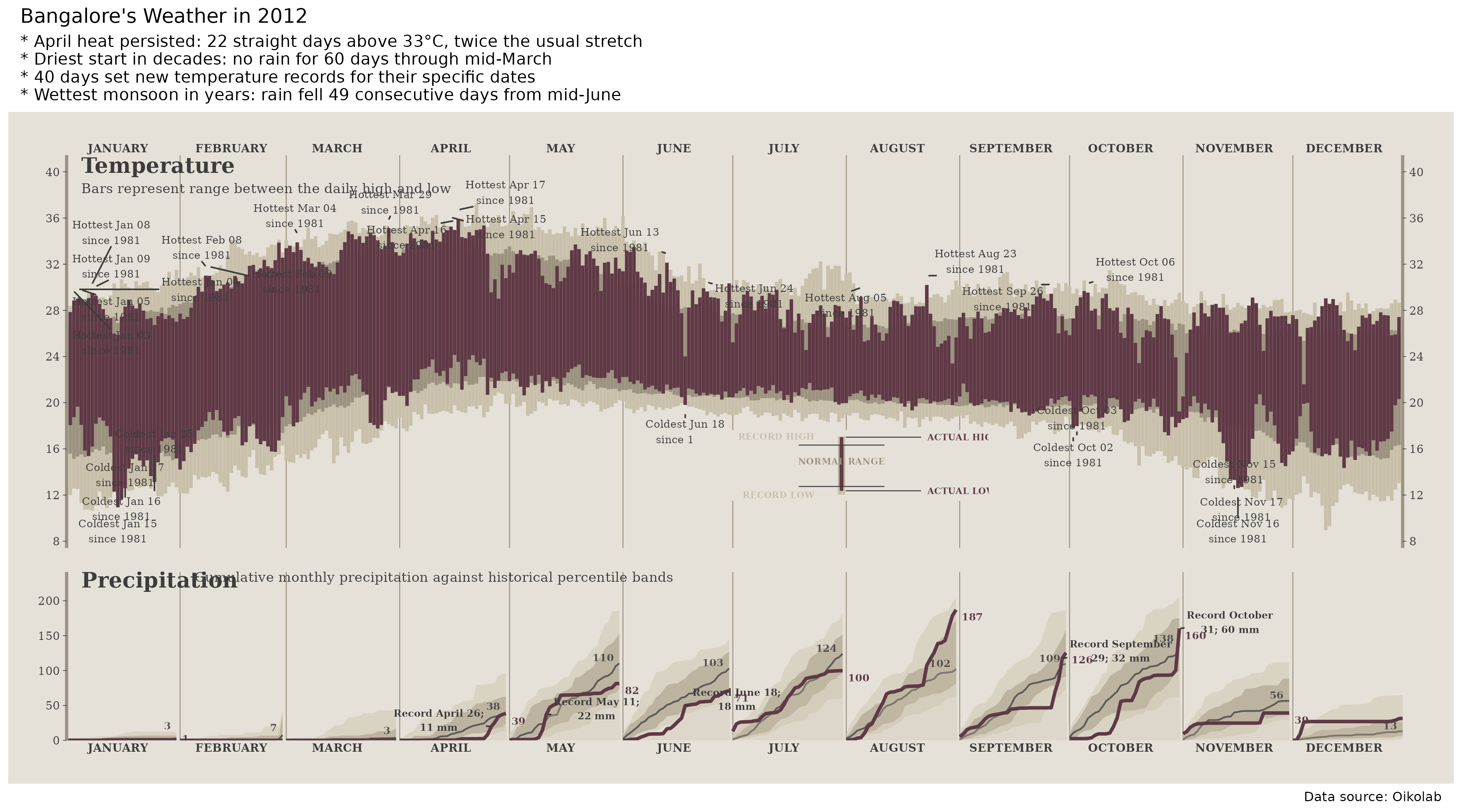
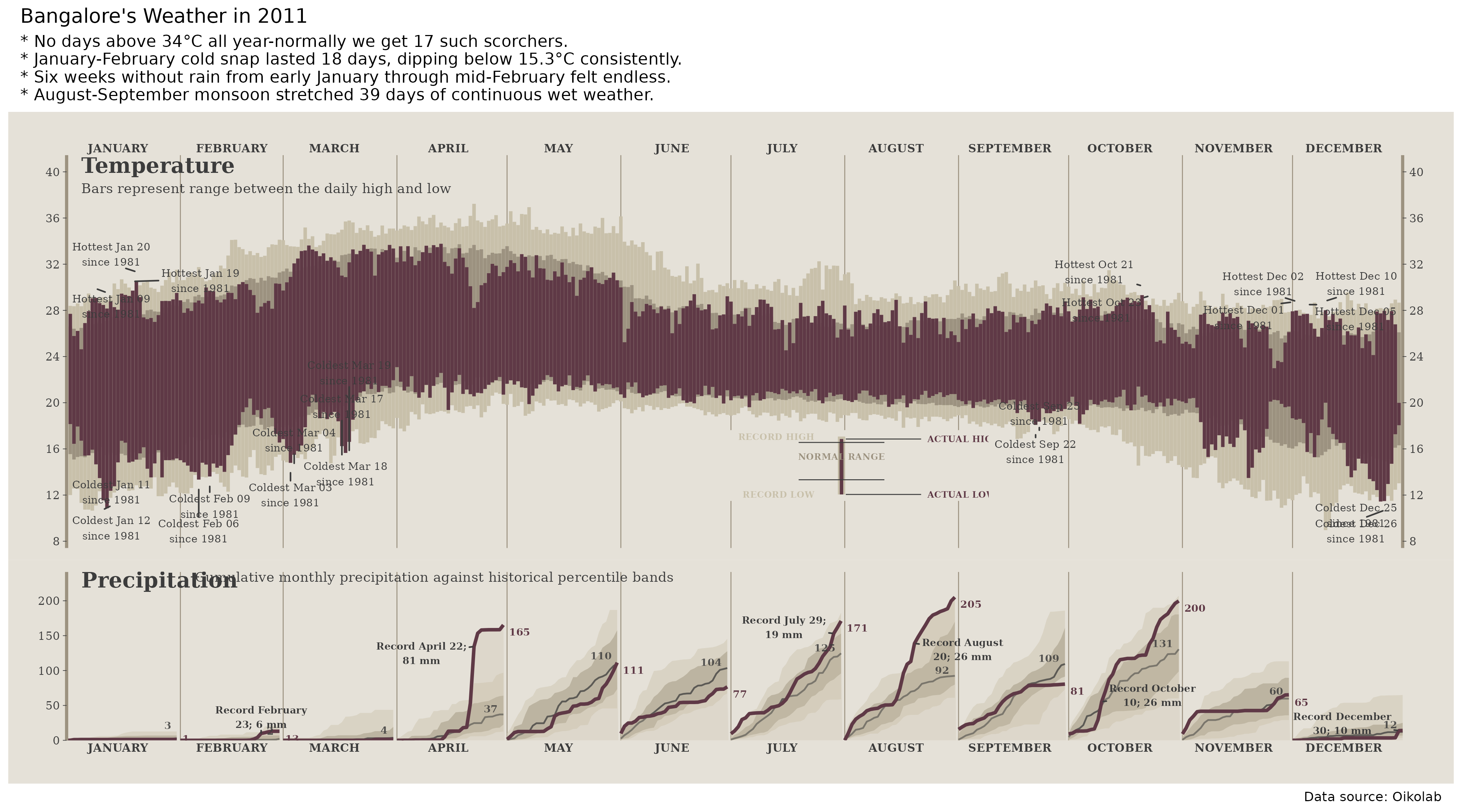
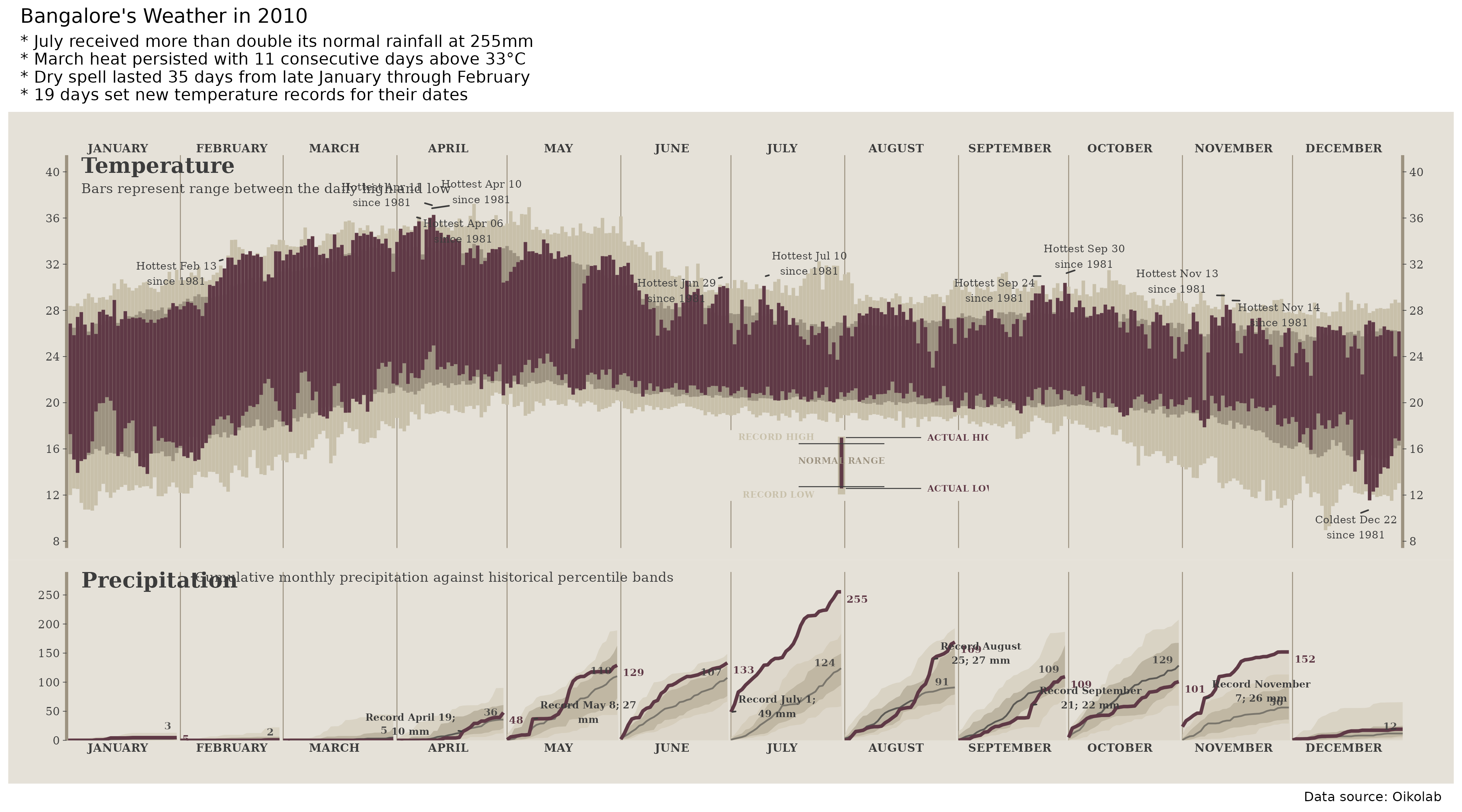
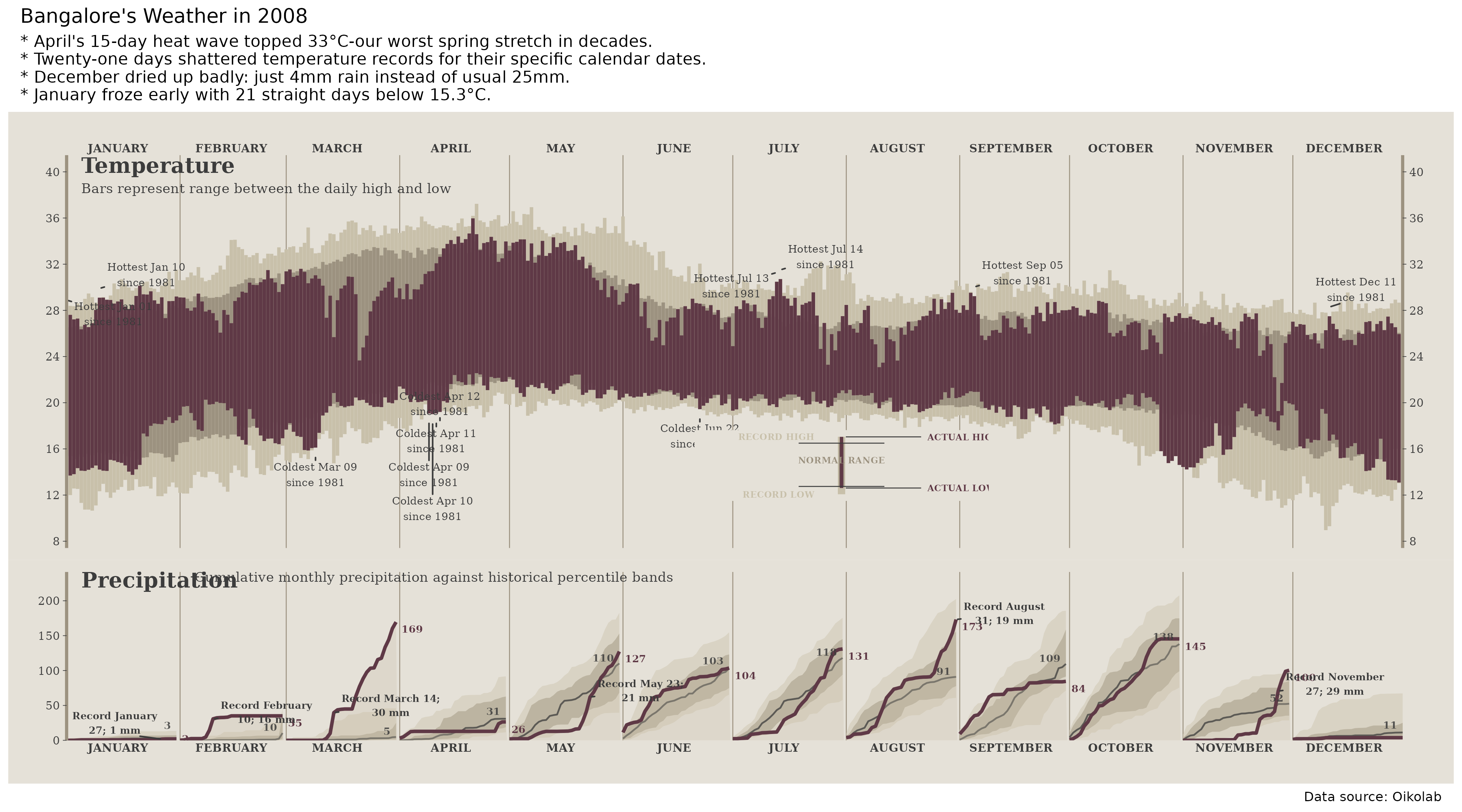
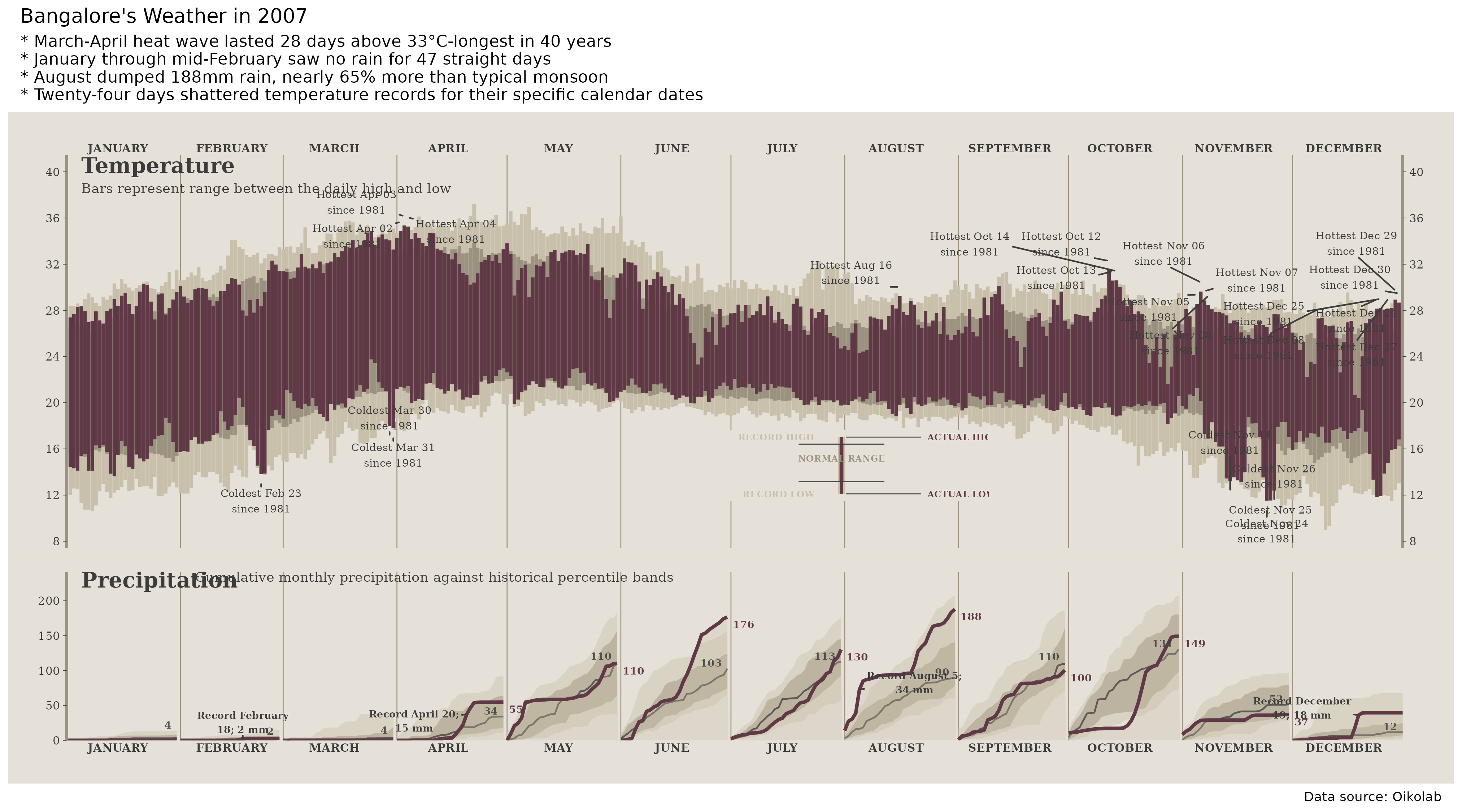
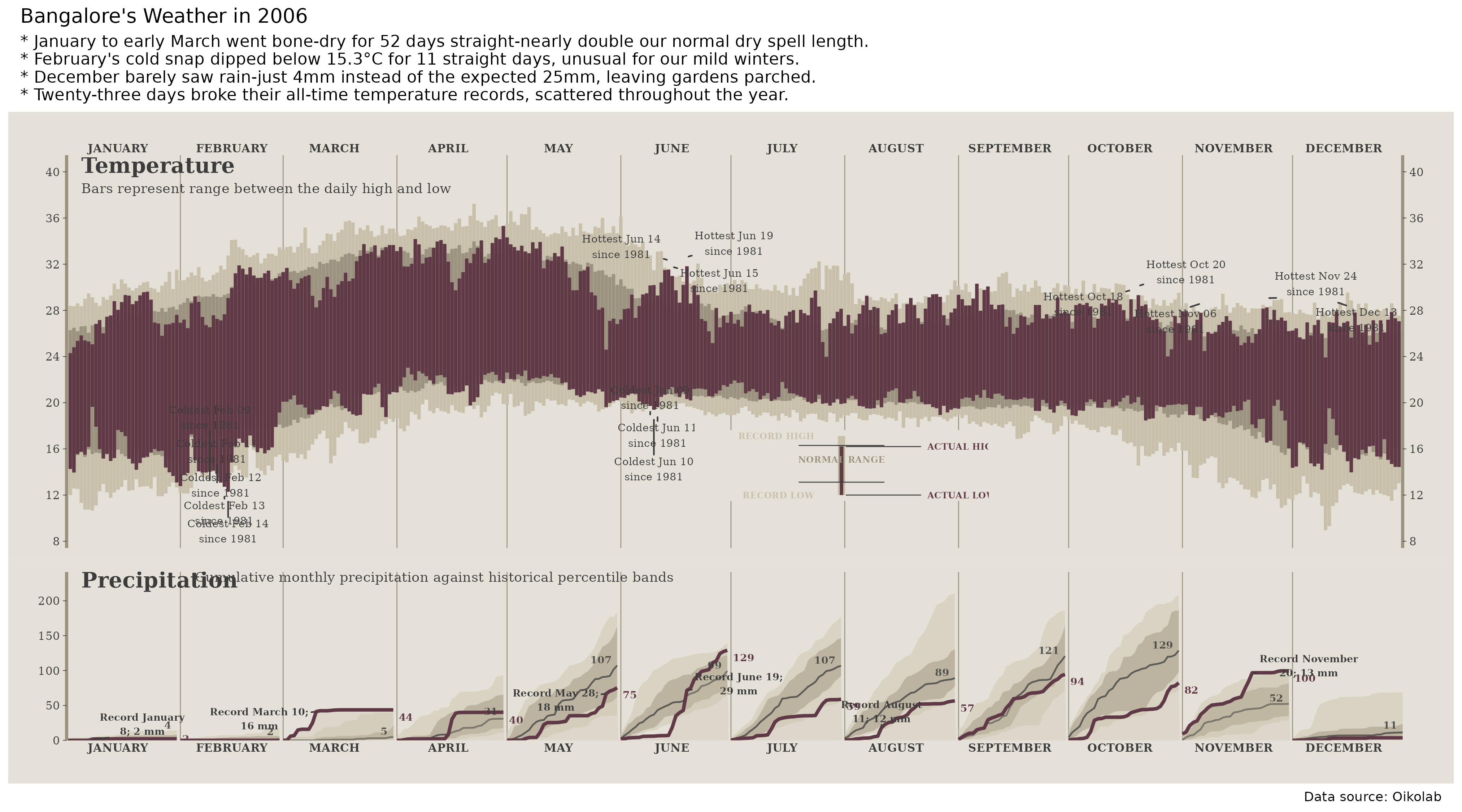
Each day gets a vertical temperature range. The current year sits on top of the normal range and the record range since 1981. Rain is cumulative within each month, because a wet month and a one-day cloudburst are not the same thing.
The subtitle is partly automated, but the analysis is not magic. R computes the weather signals first - streaks, records, rain concentration, warm nights, dry runs. The language layer only decides which of those facts deserves the headline.
Blog
The latest three analyses worth keeping around. The full reverse-chronological archive lives on the blog.
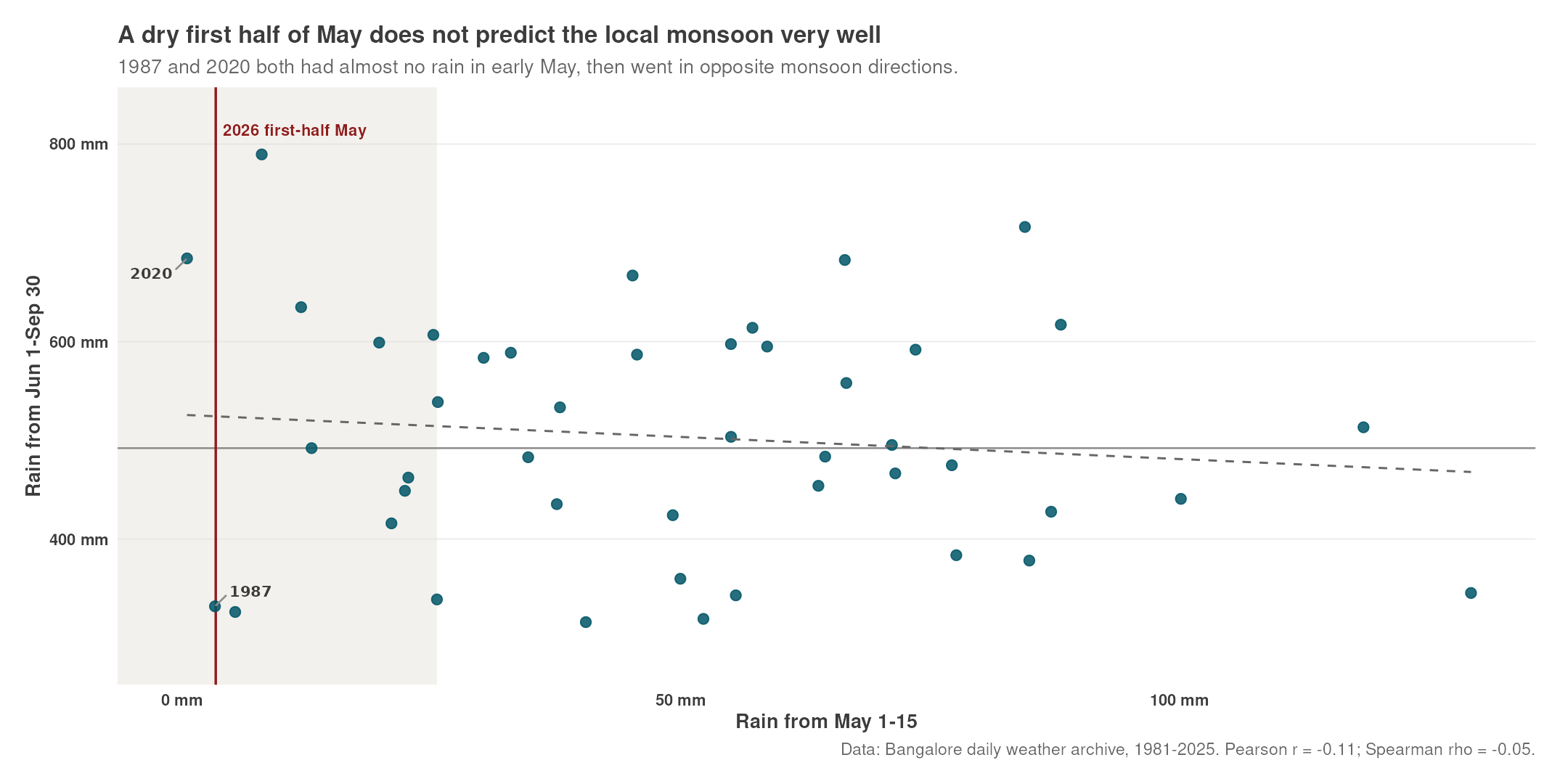
Past years
The same chart works backwards. That is the useful part: once the visual grammar is stable, 2006, 2016, or 2025 can be read against the same normals and records.
2025Warm nights, dry May
2024Record heat, wet August
2023Many records, dry year
2022Warm nights, wet July
2021Warm nights, wet November
2020Warm nights, wet monsoon
2019Wet October, hot year
2018Hot year, weak monsoon
2017Mild year, wet September
2016Hot year, June rain
2015Cool year, wet November
2014Record heat, modest rain
2013Hot year, wet September
2012Cool year, long dry spell
2011Wet year, no hot days
2010Cool year, wet July
2009Wet September, hot year
2008Cool year, wet August
2007Cool year, rainy August
2006Dry year, long dry spell

Question box
Ask the weather question that has been annoying you.
Not an instant chatbot. That is the point. If people ask good questions - did Whitefield get hotter, did October rain move later, do showers cool nights more than afternoons - I can review them in batches and turn the useful ones into new charts.
Open form in a new tab
The form will collect questions for periodic review. No automatic answers, no surprise token bill, and no pretending every question deserves a generated paragraph.
Data and caveats
The site uses hourly weather data for one Bangalore coordinate from 1981 onward. Recent days can shift slightly after late-arriving corrections, so the updater keeps revisiting the last few days instead of treating yesterday's file as sacred.
There is a separate airport-station sanity check for temperature and wind. Rain is the annoying bit: Bangalore showers are local, and the public station feeds I checked do not give a clean rainfall series. So treat the exact millimetres with more caution than the broad pattern.
Daily chart
Generated by bangalore_weather_update.R, then published into docs/.
Data source
Hourly temperature, rain, wind speed, and wind direction for Bangalore.